- Business
- Esoteric
- Fitness & Gym
- Health
- Hypnosis
- Management
- Marketing & Selling
- Massage – SPA
- Parenting
- PUA Seduction
- Science
- Self Improvement
- Art
- Investing
- Painting & Skulping
- Tai Chi & Martial Arts
- Qigong
- Taoism
- Design & Graphics
- Medicine
- Exams
- Spirituality & Religion
- Hobbies & Fixing & Woodworking
- Photography & Film Making
- Networking & Lan
- Forex & Trading
- IQ & Memory
- Vision & Eye Care
- Swimming & Scuba diving & Water Sports
- Security & Hacking
- Travel
- Cooking
- Driving & Flighting
- Languages
- Computers & Programming
- Building & Home Improvement
- Music
- Astronomy
- History
- Mathematics
- Philosophy
- Literature & Writing
- Economics & Finance
- Sewing
- Hunting
- Electronics
- Psychology & Psychiatry

Resume & Cover Letter Writing for Beginners: Get Hired
$20.00 Original price was: $20.00.$5.00Current price is: $5.00.

Sales Fundamentals For Beginners: Master The Essentials
$20.00 Original price was: $20.00.$5.00Current price is: $5.00.
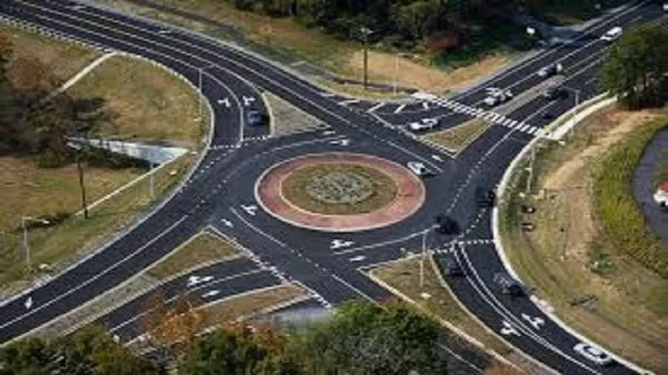
Road Project Using Civil 3D
$20.00 Original price was: $20.00.$5.00Current price is: $5.00.
Category: CAD
Description
Published 3/2025
MP4 | Video: h264, 1920×1080 | Audio: AAC, 44.1 KHz
Language: English | Size: 4.56 GB | Duration: 3h 49m
design roads via civil 3d
What you’ll learn
Convert Highway Road from Autocad to Civil 3d
Manual surface intersection and solution of the interference problem in the corridor
Alignment , Create a profile for the natural land.
SUPER ELEVATION , CORRIDOR
create project reports
Requirements
previous background of autocad
Description
. Quantity survey for excavation, fill, road layers and amounts for mixing gravel stations. Producing drawings, contour maps, cadastral maps and cut & fill reports. Use Civil 3D effectively to design and implement road works.Understand how to enter and process survey points and apply coordinate systems.Learn how to create surfaces in multiple ways, modify them, and extract data from them.Create road paths, calculate their elevations, and output their data for on-site signing. Understand how to enter and process survey points and apply coordinate systeLearn to create, modify, and extract data from surfaces in multiple ways.Create road paths, calculate their elevations, and output their data for on-site signing.Create a longitudinal road section for natural terrain and a design longitudinal section using multiple methods.Export Plan & Profile drawings to AutoCAD for printing or PDF files.Create 3D models of roads using the previous stages and create surface intersections using multiple methods.Design and construction of turning circles and sidewalks.Calculating excavation and backfill quantities for earthworks and paving layers quantities and extracting the necessary repoUnderstand how to enter and process survey points and apply coordinate systems.Learn how to create surfaces in multiple ways, modify them, and extract data from them.Create road paths, calculate their elevations, and output their data for on-site signing.
Overview
Section 1: Introduction
Lecture 1 prepare drawing
Section 2: Manual surface intersection
Lecture 2 create surface
Section 3: Alignment
Lecture 3 best Alignment
Section 4: create profile
Lecture 4 create profile of road
Section 5: cross section
Lecture 5 section
Section 6: SUPER ELEVATION
Lecture 6 SUPER ELEVATION
Section 7: corridor
Lecture 7 create corridor
Section 8: quantity survey of fill
Lecture 8 quantity survey of fill
Section 9: project drawings
Lecture 9 final drawings
Section 10: reports
Lecture 10 project reports
Road engineers and road project students,for all civil engineers
Homepage
https://anonymz.com/?https://www.udemy.com/course/road-project-using-civil-3d/
Shipping & Delivery
DIGITAL DELIVERY ONLY
This is digital product THE DOWNLOAD LINK SEND 12-24 HOURS AFTER UPON PURSUASE AND PAYMENT CLEARS"
- The digital files are uploaded on PCLOUD
- 12-24 hours delivery time
- the download links expire after 7 days and need to download them
- to renew the download link after expiration have one additional fee $5 per product
REQUESTS
Also we accept requests (in this page) and course exchanges
In Course exchanges we are sending credits only
The credits will be the same price as we can sell course
"REFUNDS & RETURNS"
No Refunds on digital product
ONLY EXCHANGE
- Because of the abuse of the refunds from many customers i don't accept refunds
- We accept only 1 time exchange with product of the same price
- if you done mistake on the exchangeable product i don't recognize it as your mistake
- Exchanges only 3 days after the payment of your digital product. (if abused again i will do it 1 day)
Related products
The Complete AutoCad 2020 2D+3D Course
Learning AutoCAD for Mac 2019
AutoCAD: 3D Architectural Modeling (2019)
AutoCAD 2019 Essential Training Course
$5.00
AutoCAD 2020 and Artificial Intelligence Tools: Part 3
$5.00


